DAMS IN IDUKKI
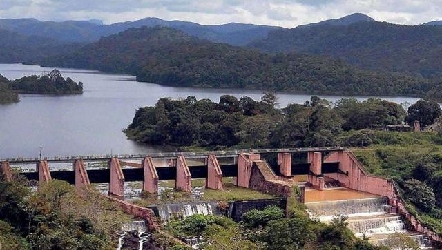
IDUKKI ARCH DAM
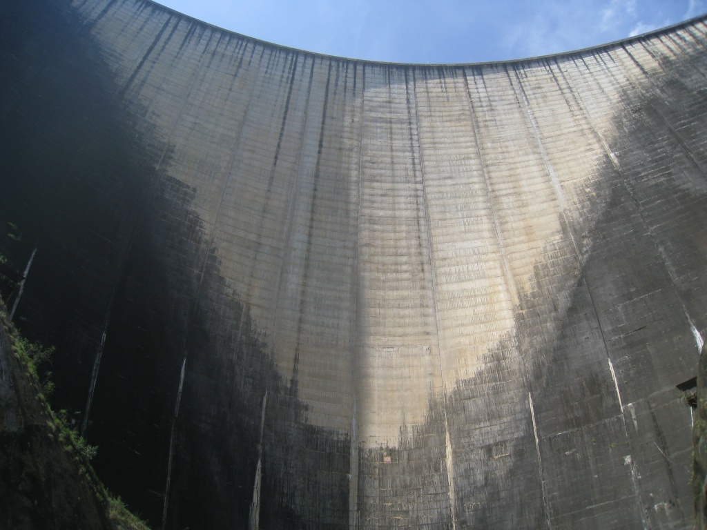
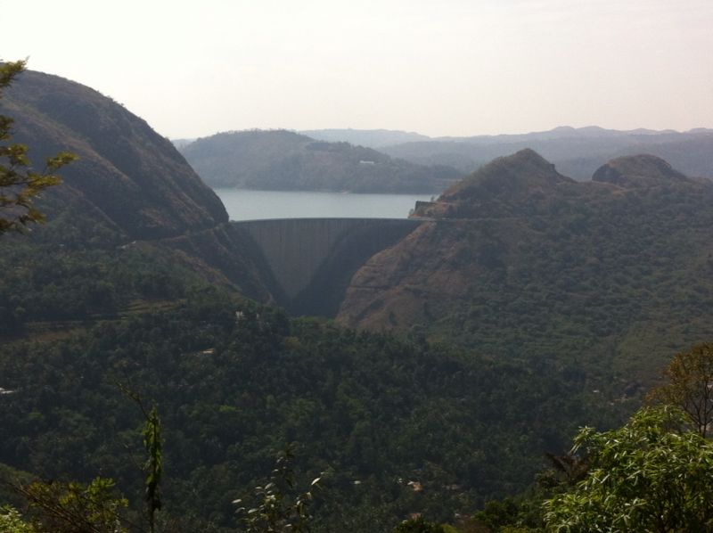
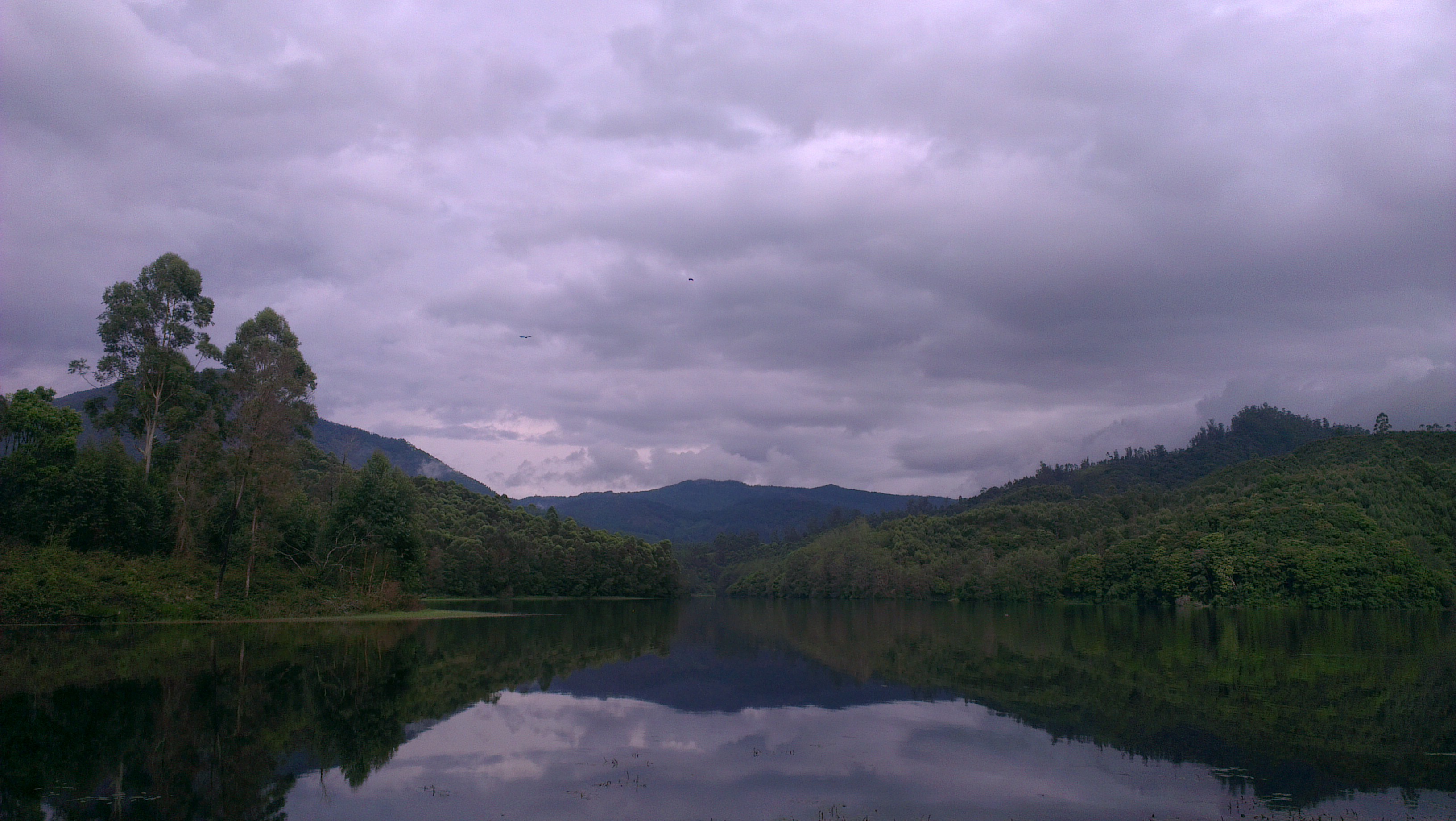
In the heart of the District lies the ‘IDUKKI DAM’ – Asia’s biggest Arch Dam of 555 feet height proudly standing between the two mountains - 'Kuravanmala' (839 meters) and 'Kurathimala' (925 meters). It is the world’s second and Asia's first arch dam. This prestigious project of our nation is situated in Idukki District and its underground Power House is located at Moolamattom which is about 19 kms from Thodupuzha. Idukki Dam is 43 kms away from Moolamattom.
The possibility of Hydroelecric development at Idukki was first conceived in 1919. As per history, Kolumban, the head of ‘Oorali’ race during 1922 showed the way, to the Malankara Estate Superintendent and his friend Thomas, who were on hunting spree in the forest, the spot of present Arch Dam. He told them of the legend of Kuravan and Kurathi Hills. The mind of Thomas was stirred by the sight of water flow between the mountains and his idea made the dream true of Idukki Arch Dam. W. J. John of Malankara Estate submitted a report to the Government of Travancore in 1932 on the possibility of constructing a dam at Idukki for Power Generation.
In 1947, P. Joseph John, then Chief Electrical Engineer to the Government of Travancore made a preliminary investigation report. On the request made by the Government, the Central Water and Power Commission took up detailed investigation in 1956. The project report was prepared in 1961 and the Planning Commission accorded sanction for implementing the scheme in 1963 and the preliminary works of the project were started.
The project was posed for Canadian aid and its scope was enlarged and a revised project report was drawn up in 1956-66. The construction of this Dam commenced on 30 April 1969. Storage of water in Idukki reservoir commenced in February, 1973. The inauguration of trial run of the first machine was celebrated on 4th October, 1975. Commercial operation of the Power Station was commissioned on 12 February 1976 by the then Hon. Prime Minister Smt. Indira Gandhi.

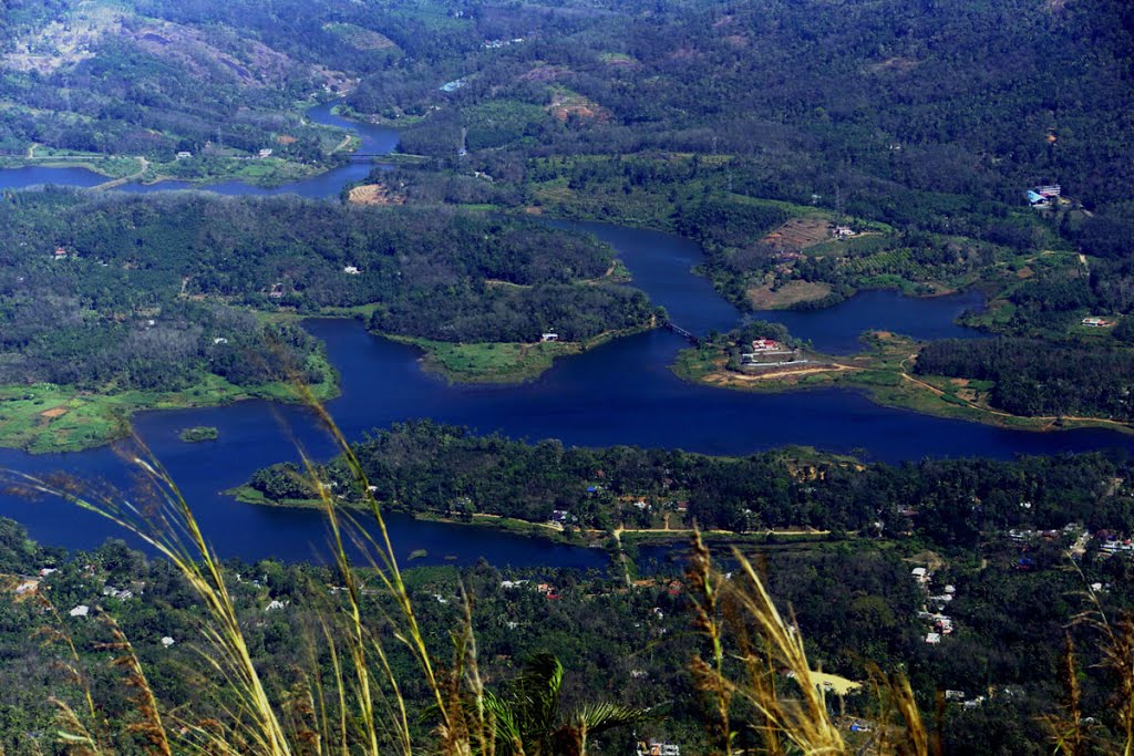
Construction of this Arch Dam and two other dams at Cheruthony and Kulamavu has created an artificial lake of 60 sq. kms width and the water stored, is utilised for production of electricity at the unique Moolamattom Power house, which is located inside the rocky caves.
The Project harnesses a major portion of the power potential of Periyar, the largest river in Kerala State, by the creation of a reservoir of 2,000 M.cum (2 Billion Tonnes) capacities, diversion of waters thus impounded through a water conductor system consisting of a power tunnel and two underground pressure shafts to an underground power house situated in Muvattupuzha Valley. The installed capacity of the Power House is 780MW consisting of 6 Units of 180 MW each. The regulated waters of Periyar falls through a tunnel about 669.2 metres (2195 feet) while generating power in the underground power house. The tail waters flowing to Kudayathur River through tunnel and open channel will later be diverted for irrigation purposes in the Muvattupuzha Valley.
ANAYIRANGAL DAM
The Anayirangal dam is one of the biggest earth dams in Asia, situated 22 kms away from Munnar (closer to Chinnakkanal). Only rock and sand used for the construction of this dam. At season the water will fill around 34km perimeter. It is surrounded by Tata Tea plantations, coffee, tea and cardamom plantations in the evergreen forests. Hanging bridge connects tea plantations on opposite sides. Water-bodies contain fishes like Gold fish, Kattala, Prawn etc… It is a popular site of elephants that is why called as Anayirangal. It is a lush green carpet of tea plants. A trip on the splendid reservoir is an unforgettable experience. Thickset forests bordering the area; and the Anayirangal dam is right in the middle. Most of the famous Hotels and Resorts in Munnar are situated nearby Anayirangal Dam.

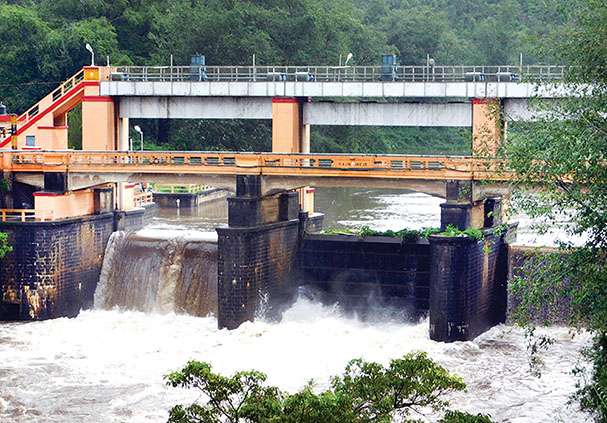
CHERUTHONI DAM
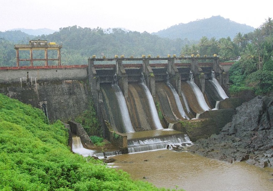
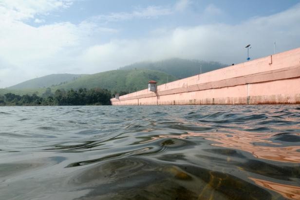
Cheruthoni Dam is a 138m tall concrete gravity dam. This dam was constructed as part of the Idukki Hydroelectric Project along with two other dams at Idukki and Kulamavu. It is built across the Cheruthoni River, which is one of the major tributaries of the Periyar River. The project was completed with Canadian aid. The Government of Canada aided the Project with long term loans and grants. S.N.C.Inc., Canada, a firm of Consulting Engineers were advising and assisting Project Engineers under the Canadian Aid. The water impounded by these three dams of Idukki, Cheruthoni and Kulamavu has formed a single reservoir spread over 60km on a height of 2300 ft above Mean Seal Level and the water stored, is used for production of electricity at the Moolamattom Power house. The spill way of the Idukki Reservoir is in the Cheruthony dam. Cheruthony is the largest and highest gravity dam in Kerala.
KALLARKUTTY DAM
The Kallarkutty Dam was constructed in 1961 as the part of Neriamangalam hydro electric project across the Muthirappuzha River. It is a gravity masonry dam, which has 183 meter length and 43 meter height. The reservoir spread about 0.648 sqkm and has 6.88 million cubic meter capacity.
KOCHU PAMBA DAM
Kochu Pampa is in the boarder of Idukki- Pathanamthitta District. It is a destination that even most people at Pathanamthitta or Idukki are not aware of. Nor do many people know of the existence of a road connecting Pathanamthitta to Vandiperiyar in Idukki. This is mainly because this road is primarily a service road for the various dams like Moozhiyar, Kakki and Kochu Pampa and the entry is restricted, because the road passes through some of the densest forests of Kerala. Kochu Pampa is a small settlement of about sixty souls near the Kochu Pampa dam. Earlier the Kerala State Electricity Board had a strong presence here and there were families settled here at the Board’s quarters. But now only a minimum of Board employees are present here and the major share of the quarters lie abandoned. A few are still occupied and there is a rest house and canteen still functioning.
There is one bus servicing this settlement. This bus operates every evening from Vandiperiyar halts for the night at Kochu Pampa and returns in the morning. Kochu Pampa is approximately at a distance of forty kilometres from Vandiperiyar. Six kilometers from Vandiperiyar we enter the forest through the check post at Vallakadaavu. Sighting of wild animals on the road is a regular feature and leopards, bison, deer and elephants were regularly seen. The dam and its environs were beautiful but it was the lower reaches that were really beautiful. The river Pampa flowed in all majesty and the forest lining the banks were very dense. A tree called “Nirampalli”, which has the botanical name Boro Carpus is seen here and it is said to be the only specimen of its kind in Asia. It is also said to be the Biblical Gopher wood tree from which Noah constructed his Ark.

KULAMAVU DAM
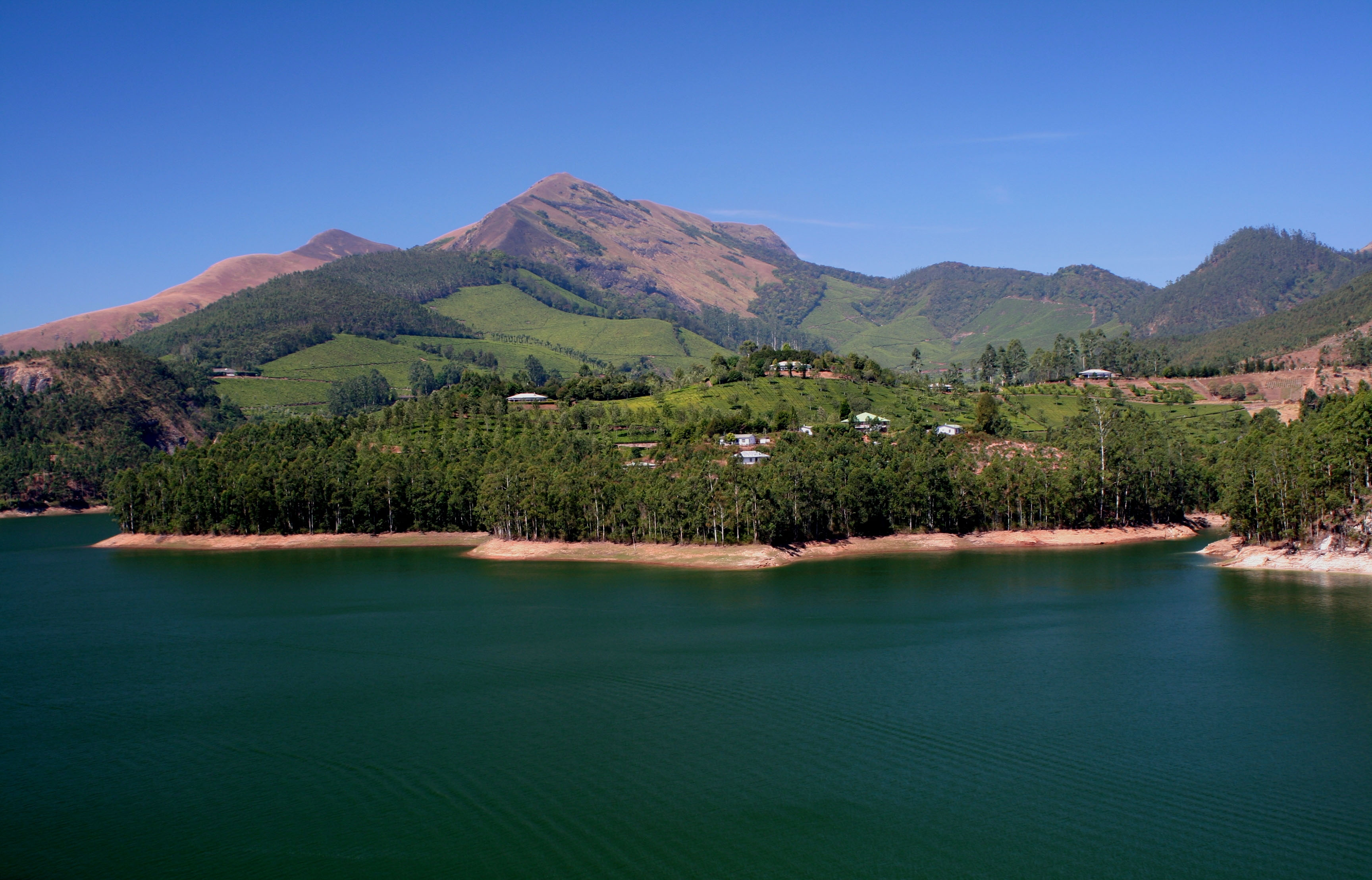
Kulamavu Dam, one of the three dams of Idukki Reservoir Project, is situated at Kulamavu a famous hill station in Idukki District. The Dam is constructed in 1961. Kulamavu Dam was constructed to prevent the water escape through a rivulet called Kallivally, 30 km west to Idukki Arch Dam. It is a 100 metres tall Masonry gravity dam. Kulamavu extends between rocky hills to form the 33 sq km reservoir. Being in the lower part of the high ranges of Kerala, Kulamavu enjoys a salubrious climate. Rubber and spice plantations flourish here. Various species of birds have been sighted in this area. Some of the common ones are: darter or snake bird and king fisher.
KUNDALA DAM
Kundala a tranquil, serene place with alluring, ravishing beauty offers incomparable experience to travellers. Situated at 1700 Mtr above sea level, Gundala Lake is located at 25 Km away from Munnar on the way to Top Station, located amidst a dense forest. The construction of Sethuparvathy Dam at Kundala was completed in the year 1946, as a part of Pallivasal Hydro Electric Project, when it was found that the reservoir at Munnar was not getting adequate water. Kundala Arch Dam is Asia’s first Arch Dam. Kundala lake and its surrounding area offer a calm and quiet atmosphere with quiet natural beauty. Kerala State Electricity Board has arranged boating facilities in the lake. Beautiful Kashmiri Shikkara boats, pedal boats and row boats are available on rent. Boating in this dam is an experience beyond words.
LOWER PERIYAR DAM
Lower Periyar Dam is the part of Lover Periyar Hydro electric project. It is commissioned in 1999. It is a concrete gravity dam. The dam has 39 meter height and 244 meter length.

MALANKARA RESERVOIR
Malankara Reservoir is located at a distance of about 6 Km from Thodupuzha, this splendid artificial reservoir is a popular attraction among tourists. The reservoir is an ideal setting to enjoy a boating trip or to just laze around and do some fishing. This lake could be accessed by road. The shimmering golden water of the reservoir is sharply contrasted by the surrounding emerald greenery.
MADUPETTY DAM
The dam of Mattupetty is a storage concrete gravity dam. The dam was constructed under the Pallivasal Hydro-electric project in the late 1940s, for the purpose of water conservation and power generation. Mattupetty Dam was opened in 1953. Now the dam is a vital source of electricity generation in Munnar and also a haven for many wild animals and birds due to its constant water availability. The surface area of the dam is 323 hectares.
The most attractive part of Mattupetty dam is its still water which reflects the tea garden around. You can engage yourself with water sport activities like speed boating organized by District Tourism Promotion Council of Idukki (Munnar) and enjoy
the pretty natural surroundings of this beautiful dam. Speed launch, slow speedboat and motorboats are available on hire. You can also have a ride on elephants along the pathways between the dam and tea gardens. Adventure lovers also have options here like trekking in the Shola forest.

MULLAPPERIYAR DAM
The Mullaperiyar Dam is a masonry gravity dam built on the Periyar River in Kerala. The dam is located 2889 feet above mean sea level on the Cardamom Hills of the Western Ghats in Thekkadi, Idukki District. It was constructed between 1887 and 1895 by John Pennycuick to divert water eastwards to the Madras Presidency area (present-day Tamil Nadu). The Periyar National Park in Thekkady is located around the dam’s reservoir. The dam is located in Kerala on the river Periyar, but is operated and maintained by Tamil Nadu state. Although the Periyar River has a total catchment area of 5398 km2 with 114 km2 in Tamil Nadu, the catchment area of the Mullaperiyar Dam itself lies entirely in Kerala.
The Mullaperiyar Dam is a gravity dam made with concrete prepared from limestone and "surkhi" (burnt brick powder), and faced with rubble. Gravity dams use their weight and the force of gravity to support the reservoir and remain stable. The main dam has a maximum height of 53.6 m (176 ft) and length of 365.7 m (1,200 ft). Its crest is 3.6 m (12 ft) wide while the base has a width of 42.2 m (138 ft). It consists of a main dam, spillway on its left and an auxiliary dam (or "baby dam") to the right. Its reservoir can withhold 443,230,000 m3 (359,332 acre·ft) of water, of which 299,130,000 m3 (242,509 acre·ft) is active (live) storage.
The unique idea of harnessing the westward flowing water of the Periyar river and diverting it to the eastward flowing Vaigai river was first explored in 1789 by Pradani Muthirulappa Pillai, a minister of the Ramnad king Muthuramalinga Sethupathy, who gave it up as he found it to be expensive. The location of the dam had first been scouted by Captain J. L. Caldwell, Madras Engineer in 1808 to reconnoitre the feasibility of providing water from the Periyar River to Madurai by a tunnel through the mountains. Caldwell discovered that the excavation needed would be in excess of 100 feet in depth and the project was abandoned with the comment in his report as "decidedly chimerical and unworthy of any further regard".
The first attempt at damming the Periyaar with an earthen dam in 1850 was given up due to demands for higher wages by the labour citing unhealthy living conditions. The proposal was resubmitted a number of times and in 1862, Captain J. G. Ryves, M.E., carried out a study and submitted proposals in 1867 for another earthwork dam, 62 feet high. The matter was debated by the Madras Government and the matter further delayed by the terrible famine of 1876-77. Finally, in 1882, the construction of the dam was approved and Major John Pennycuick, M.E., placed in charge to prepare a revised project and estimate which was approved in 1884 by his superiors.
On 29 October 1886, a lease indenture for 999 years was made between the Maharaja of Travancore, Visakham Thirunal Rama Varma and the British Secretary of State for India for Periyar Irrigation Works. The lease agreement was signed by Dewan of Travancore V Ram Iyengar and State Secretary of Madras State J. C. Hannington. This lease was made after 24 years negotiation between the Maharaja and the British. The lease indenture granted full right, power and liberty to the Secretary of State to construct make and carry out on the leased land and to use exclusively when constructed, made and carried out, all such irrigation works and other works ancillary thereto. The agreement gave 8000 acres of land for the reservoir and another 100 acres to construct the dam. The tax for each acre was 5 per year. The lease provided the British the rights over "all the waters" of the Mullaperiyar and its catchment basin, for an annual rent of 40,000.
The dam created a reservoir in a remote gorge of the Periyar river situated 3,000 feet above the sea in dense and malarial jungle, and from the northerly arm of this manmade water body, the water flowed first through a deep cutting for about a mile and then through a tunnel, 5704 feet in length and later through another cutting on the other side of the watershed and into a natural ravine and so onto the Vaigai River which has been partly built up for a length of 86 miles, finally discharging 2000 cusecs of water for the arid rain shadow regions of present-day Theni, Madurai Sivaganga and Ramanathapuram districts of Tamil Nadu, then under British rule as part of Madras Province (Sandes, 1935).
The Periyar project, as it was then known, was widely considered well into the 20th Century as “one of the most extraordinary feats of engineering ever performed by man”. A large amount of manual labour was involved and worker mortality from malaria was high. 483 people died of diseases during the construction of this dam and were buried on-site in a cemetery just north of the dam.
The Periyar National Park in Thekkady, a protected area of Kerala, is located around the dam’s reservoir, the 26 km2 (10 sq mi) Periyar lake. 62 different kinds of mammals have been recorded in Periyar, including many threatened ones. Periyar is a highly protected tiger reserve. It is declared an elephant reserve on 2 April 2002. Other mammals also found here include gaur, Bison, sambar (horse deer), barking deer, mouse deer, Dholes (Indian wild dogs), mongoose, foxes and leopards. Four species of primates are found at Periyar - the rare Lion-tailed macaque, the Nilgiri Langur, the common langur, and the Bonnet Macaque. According to a report by the Kerala Forest Research Institute, the protected area surrounding the dam and reservoir is classified as a biodiversity hot spot.
Munnar Head Works Dam
Ramaswamy Iyer head works dam is one kilometre away from Munnar town and while it is not much of a sight, it at least has the sound. This is where water from the Madupetty river flows into the Ramaswamy head works dam and then through a tunnel to the pipeline that goes to the Pallivasal hydroelectric project. A quiet family oriented park set in 16 acres of wood land and fresh water fishing river where you can enjoy boating, feeding the water ducks or just relaxing. It is surrounded by beautiful Ulnus trees.

PONMUDY DAM
Ponmudi Dam in the Idukki District is constructed across the Panniar River, a tributary of the Periyar. Built in 1963, it has a length of 294 m. The dam is about 15 km from Adimali, on the way to Rajakkad. Surrounded by forests and green lands, Ponmudi Dam is ideal for holidaying. With a picturesque view of the Western Ghats, trekking in the Panniar River is a bit adventurous. Fishing can also be enjoyed. The old bridge, Thookkupalm, built by the British is a unique attraction. Vellathooval Power House, Kallarkutty Dam, Kuthumkal Waterfalls and Sengulam Dam are some of the nearby attractions. Frequent buses are available from Adimali and Rajakkad.