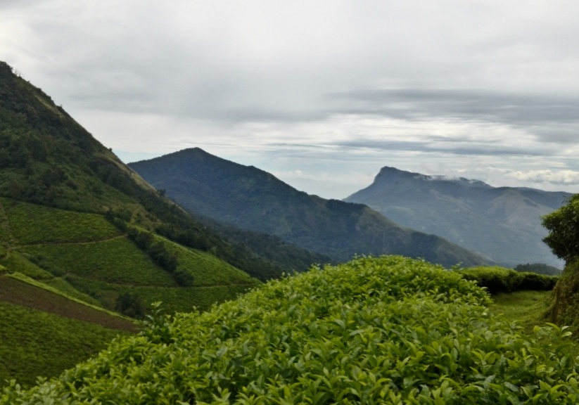
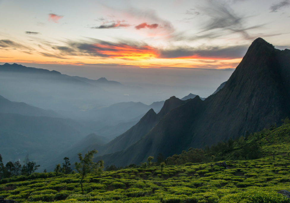
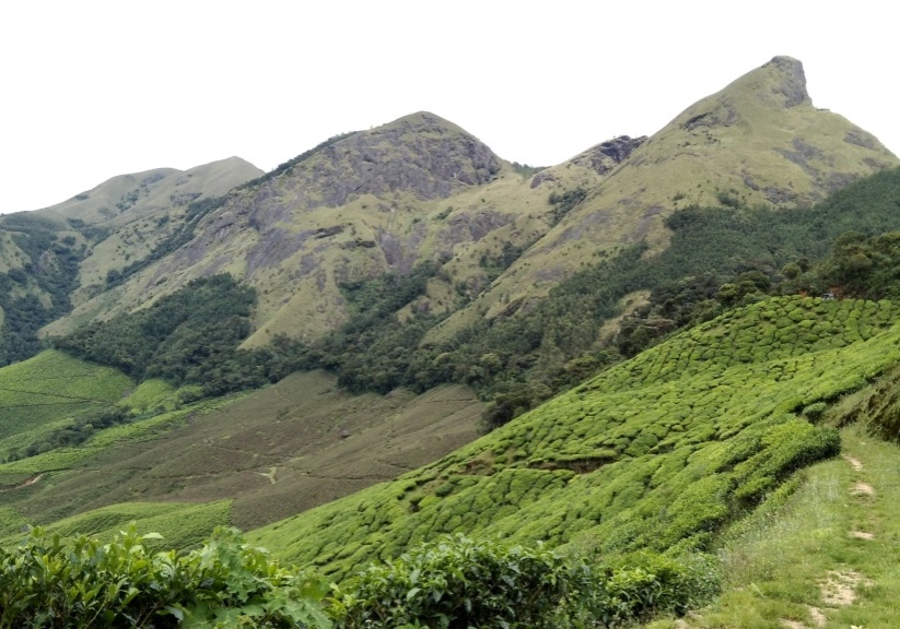
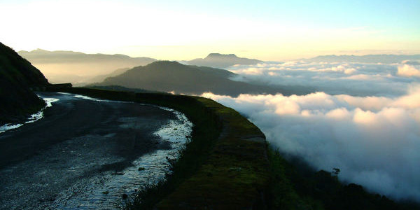
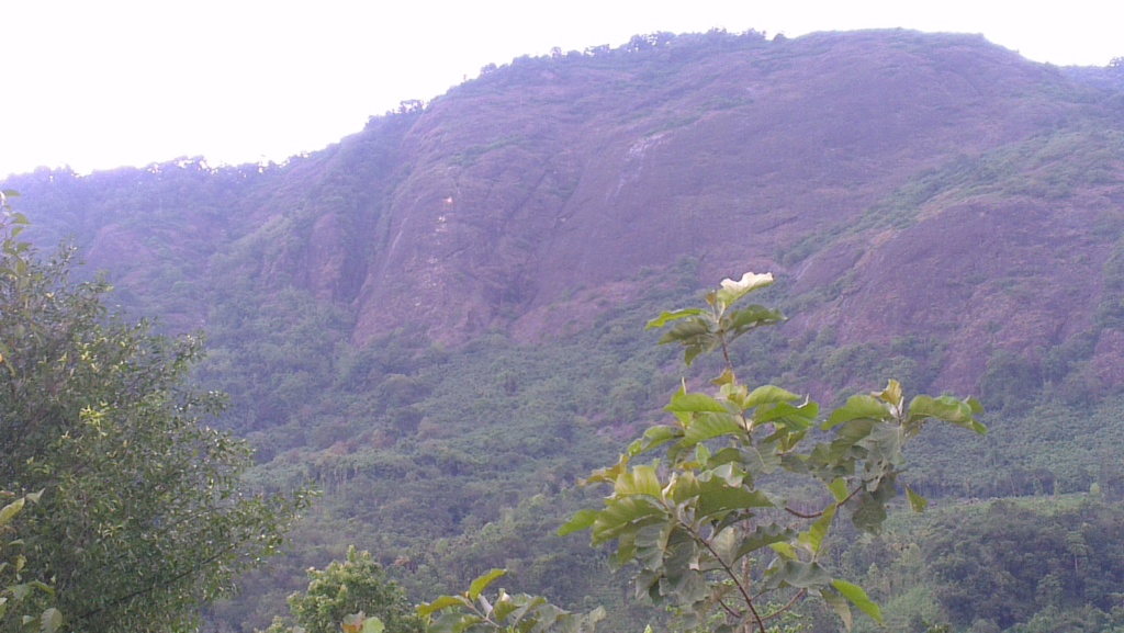
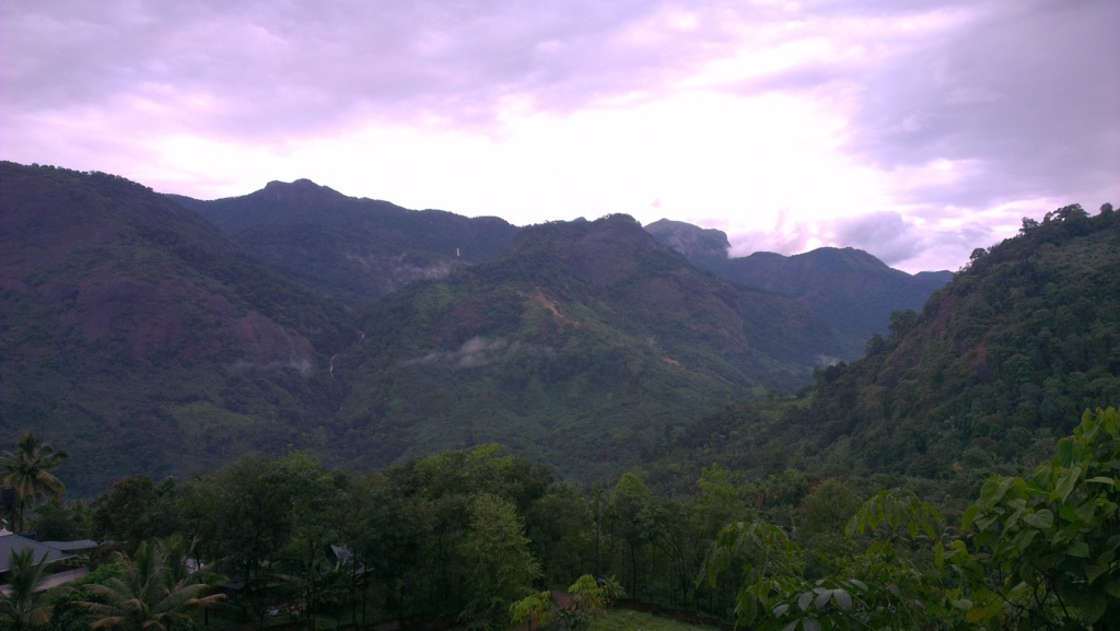
MUST SEE PLACES IN IDUKKI
Adimali
Adimali is located on the National Highway 49 (India) connecting Kochi and Madurai. The waterfalls Cheeyappara and Valara are located nearby. Pepper cultivation is the main agricultural activity of this place. Adimali is known for its proximity to Munnar and natural beauty. Kallar is another beautiful place located 14 km from Adimaly. Adimaly has almost all the basic facilities like well connected roads, educational institutions and hospitals. The former name of the Adimali area was Mannamkandam, as the name indicates the Mannan tribe once populated the area. Other tribal groups collectively called the Muthuvan were also living in Adimali. Before 1980, the main crops under cultivation were rice as well as pepper and cardamom.
Anakkulam
Anakkulam is a place where pachyderms come in herds to make merry in the water when the jungle and land stand bathed in moon light. Ten or twelve elephants come one behind another to have a shower here. After one enjoys the shower the next ventures for the same. We can sit on the banks enjoying the scene. They enjoy the shower in peace unmindful of the surroundings. They wash their calves, sometimes engaging in little quarrels, pushing others, but that won’t last long. When they finish their fun of bathing and playing, they return peacefully into the darkness of the jungles. It is a picture, which would never fade when the night and moon falls. On hearing about Anakkulam, it seemed like a beautiful dream of dreamer.
Some time the elephants make visit in day light too. If they descend, the news will spread like wild fire and travellers from Munnar will rush in jeep to have a glimpse of them. Some time the elephants make visit in day light too. If they descend, the news will spread like wild fire and travellers from Munnar will rush in jeep to have a glimpse of them. More elephants would come down during the month of December, January and summer. When there is heavy rush in Sabarimala and when the temple opens, the elephants from that forest too, would come here. Anakkulam comprises of five or six small shops, small houses, a temple, church, grumandir and Eetta Cholayar river. The volley ball court of the place is situated near the `Ana Oru' (Elephant Pit) where elephants come for shower. When elephants descend, the player’s stop playing and becomes spectators.
Chithirapuram
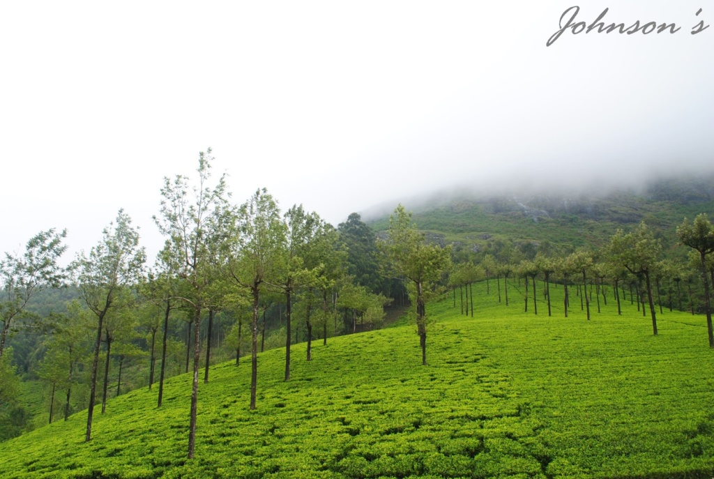
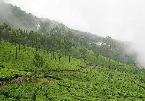
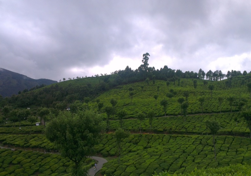
Picturesque Chithirapuram is the site for the Pallyvasal Hydel Power Project. Long arrays of beautiful cottages, bungalows, shopping areas, playgrounds and courts, all designed in an old town's style, and gives one the feeling of being part of an exquisite painting. Many lovely tea plantations make the place even more exotic.
Devikulam
Devikulam is an enrapturing hill resort, situated at 12 km from Munnar. Devikulam and Munnar are collectively known as cousins. As per legends, Goddess Sita took bath here. So the lake is named Sita Devi Lake meaning Goddess Sita Lake. Water of the lake is considered medicinal. If you fancy fishing at the heights of a hill station, well, Devikulam Lake is a great choice around. This hill resort represents nature in its most untarnished form. It is thickly covered with the aroma of wild flowers and rare herbs; thus, making it a wonderland for any nature admirer. In Devikulam, you can capture immense picturesque surroundings. It has some beautifully surging waterfalls and a stunning lake.
Gavi
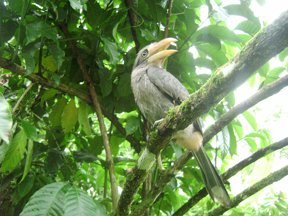
Gavi is an eco-tourist spot in Kerala which has widely become popular after ‘Alistair International’, the world acclaimed tourism major listed it among the leading eco-tourism centres and one of the must-see places in India. A must visit place for all nature lovers as Gavi is preserved in its natural scenic beauty untainted by the mighty hands of modernity. Gavi is mainly known for its wildlife. Endangered species including the Nilgiri Tahr and Lion-tailed macaque are often sighted at the outskirts of Gavi. Elephants can be sighted abundantly. If you are the bird watcher, Gavi is the place for you. With more than 260 species of birds including the great pied hornbill, woodpecker, and kingfishers, Gavi is a heaven for birdwatchers.
Hill View Park
This beautiful park, perched on top of the verdant hills, sprawls over an area of 8 km dotted with emerald green lawns, exotic plants and views to thrill you beyond imagination. The park is at a height of around 350 ft above Idukki and Cheruthoni dams water level and has a natural water body. It offers breathtaking panoramic views of the reservoir and the adjoining wilderness. The park is an ideal place to spot elephant herds roaming in the wilderness and for taking boat rides in the tranquil lake. The medicinal plant garden and children’s play area add further charm to this beautiful park.
Kallimali View Point
Kallimali View Point is located in Rajakkad Panchayath in Idukki District. It is approximately 2 kms away from Rajakkad junction and 18 kms from Munnar. It gives picturesque view of the river flowing down and the land patches in the water enhances the beauty of the site. A tribal village is located near this place. This destination is as beautiful as Munnar. This destination has enough potential for developing as a beautiful viewing spot. It is an unspoiled and unseen tourist spot surrounded by spice plantations and village farms. It is an ideal place for trekking and open jeep safari.
Kallyanathandu - Kalvari Mount
Kalyanathandu with its vast watery expanses and the distant blue hills kissing the skies is surely a paradise on earth. Just climb down the hill and there is the forest, rich in a variety of flora and fauna. From a top Kalyanathandu, the view across the land is breath taking. If one is fortunate enough, he might see elephants crossing the river. Devotees use to come during good Friday due to the presence of wooden cross near the hill and so the place is also known as Calvary Mount.
30 mint treks will take you to the top of the mountain. Trekking through the lovely dark and thick forests is quite a blissful experience, with the well maintained serpentine path which is used even in the rainy season makes the trek less hectic and more exciting and after reaching the top of Kalyanathandu and exploring the sensation view across is truly delight to enjoy. Other tours from Kalyanathandu are amazingly beautiful places like Narakakkanam tunnel and Idukki Dam etc.
Kanthaloor
Kanthaloor is a village nestled in the Western Ghats of India. The salubrious climate and the picturesque landscapes and wide variety of tropical crops coupled with the close proximity of Munnar have transformed this village into a tourist destination. This village can be called the land of fruits, since the main cultivation of the place are fruits like apple, plums etc...
Kattappana
Kattappana is a town in the Western Ghats) in Kerala, India. It is the main commercial town in the high ranges of Idukki district and is situated 2,660 feet (810 m) above main sea level, in the High Ranges, the high altitude region of Kerala. It has become one of the commercial towns and is the spices capital of Kerala. Migrations during 1950− 1970, of Kattappana people from different parts of nearby townships like Palai, Kottayam etc. The main occupation was cultivation of commercial spices like Tea, Coffee, Pepper, Cardamom, Black Pepper etc., and majority of them are farmers.
Kolukkumalai
Located high on the slopes of Meeshapulimala, Kolukkumalai is arguably the estate with the highest grown tea in the world! Started in the early 1900s the estate produces tea using the orthodox method in the time tested tea factory. Little has changed here since the colonial planters left leaving behind their legacy of one of the best quality tea you can get in South India.
Kolukkumalai gets a fair number of day visitors to enjoy the spectacular sunrise over the Palani hills, it’s cool climate and of course visit to the factory where tea is still made using the orthodox method. Kolukkumalai gives great mountain views and excellent opportunities for walks in the hills. What most day visitors miss is the opportunity to walk the hills above the estate and maybe a trek up Meeshapulimali, an imposing peak at an elevation of 2640meters (8661 feet) above sea level!
Kolukkumalai is accessable only by jeep or on foot across the mountains. Kolukkumalai is a paradise for nature lovers with a variety of flora and fauna endemic to the area and opportunities to walk up its slope for some spectacular scenery of the peaks and swirling clouds below...
The Kolukkumalai Peak is one the main landmarks of the estate. This impressive peak of about 7000 feet (approx. 2280 mts) is the first peak that you see as you enter the estate. With near vertical face one side and tall pointy peak the Kolukkumalai peak is ideal for people look for a day walk and a picnic overlooking the valley of Suryanelly. The trek up this peak starts from the entrance gate of the estate and is mostly through the tea estate and paths until you get to the shola near the top. There are bits on the walk that would require a moderate amount of fitness. You will be well rewarded once you get to the top as you get a panoramic view of both the peaks in Tamilnadu and Kerala!

Kulamavu
The beautiful lake and adjoining wilderness adds to the beauty of the place making it an ideal picnic spot. Kulamavu dam lies in the vicinity of the Idukki dam. The area is also perfect for a trekking expedition or mountaineering. The location is also a vantage point offering panoramic views of the beautiful countryside.
Kumily
Kumily is a town in Cardamom Hills near Thekkady and Periyar Tiger Reserve, in the Idukki District of Kerala. Kumily lies in the National Highway 183 that connects Kottayam through Mundakkayam and Kanjirappally. Kumily situated in Periyar Valley, drops off to the plains of Tamil Nadu. It is a major tourist destination and a spices trading centre.
Kumily, is a plantation town closely associated with Thekkady. While Thekkady is a sleepy, picturesque place garbed in greenery, Kumily is a busy town. The spice and tea plantations and the bustling spice trading activities have made Kumily one of the important tourist and commercial centres in Kerala. Apart from being the main bus station in the Periyar region, the town also provides decent, affordable accommodation facilities to tourists. Apart from tourists, Sabarimala devotees and workers from Tamil Nadu also visit Kumily from time to time.
Kuttikkanam
Kuttikkanam is a village in Idukki district, Kerala, which is 3,500 feet (1,100 m) above sea level and surrounded by lush green tea plantations. It is within the territory of Peermade. Kanjirappally and Mundakkayam are the nearest cities. In the 16th century the territory was under the rule of Changanacherry kings and was uninhabited. In 1756, the King of Travancore conquered the land and brought the place under his supremacy. A Church Mission Society missionary, Henry Baker, started coffee plantations, and under the regency of Sri Moolam Thirunal these became tea plantations.
Under the British Raj in India, Kuttikkanam became an up-market resort. Since at first there was no road but only a pathway, the British started the Aerial Ropeway Ltd, Travancore state’s first public limited company. The summer palace of the Travancore kings was located in Kuttikkanam. During the British period and after, manpower was brought to Kuttikkanam from various parts of Kerala and Tamil Nadu. The descendants of these migrant workers constitute the major part of the population of Kuttikkanam.
Lock Heart Gap
Lockhart Gap View point is located at 13 Km away from Munnar on the way to Munnar-Madurai National Highway. It is a place for adventure tourism, ideal place for trekking, mountaineering and nature walks. Lockhart Gap is known for its winding trails leading to scenic heights. The hilltops here offer some amazing sights of valleys and plantations. And the sights would be much prettier during evenings when the whole surroundings get illuminated in the orange glow.
When going to Munnar from Adimaly side just before reaching Munnar you can see two majestic hills standing on the right side of the road in a distance in the midst of vast tea estates, one is Chokramudi. It stands as a unique piece of Elevated Mountain at an altitude of almost 7200 feet (not very exact

as there are seldom any authentic descriptions on this peak in internet.) Unlike the other hill ranges in Idukki it stood separately and is not attached to any other hills or ranges of hills. The actual base of the peak is in Bisonvally, the trekking starts from gap road. From Munnar it is almost 16 km towards Madurai SH gap road and right from the curve from where the actual gap road begins the trekking can be started.
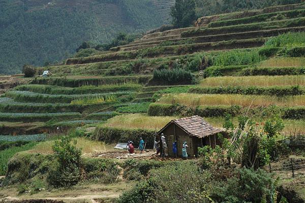
Mankulam
Let’s call it a paradise, or heaven, or the Garden of Eden. Mankulam puts everyone in a dilemma of choosing the right adjective/synonym for it. Conjuring the imagination of the nature lovers, it’s a perfect hideout for those who romance the nature. Mankulam, kaleidoscope of the nature, reveals pleasant moods and images of nature. 2500 feet above the sea level, it enthrals by its lush greenery and exotic fauna. As the clocks tick, Mankulam splendidly changes itself. In a distance it may be bright and sunny but on the other the thick dark clouds are ready to pour out.
The innumerable perennial waterfalls ornate Mankulam like the diamond ear fall. And as the rain touches down more of them come alive. Narakakuthu, Kozhiyalakuth, Nakshathrakuthu, Kozhivalankuthu, Perumbankuthu are some of them but several falls left uncharted. Miracle pond, a pond that miraculously appear at the top of the hill finding its way thru the heart of the rocks, it’s the place where herds of wild animals find solace to drink. Mankulam’s flora charms every one. Cardamom, coffee, aracanut, rubber, and paddy fields duvets its surface with rich greenery. As explore more you may come across some breathtaking sights that can make you stand in awe for its creator.

Do you dare to do some adventure? Do some balancing acts at the hanging bridge at the same time see alluring virgin forest by its side? And as you climb up the mountain, clouds start to embrace you. Leaving you blinded in its love for a moment. Or else you can take the snaps of elephants that come to drink from the salt stream. And go walking through century old pathways made by British. Spot some British-built bungalows by the way of horse ride path. Do whatever; Mankulam etches some of the best pictures of paradise, heaven and Garden of Eden in your heart.
Marayoor
Marayur or Marayoor is located 42 kilometers north of Munnar on SH 17 connecting Munnar with Udumalpet, Tamil Nadu. Marayur is the only place in Kerala that has natural sandalwood forests. Ancient dolmens and rock paintings in Marayur date back to the Stone Age.
The most probable meaning of the place name is the Uru (Village) of Maravars; a tribe lived in this area during the turn of Christian Era, who used to attack travelers for looting, hiding in the forest. The word meaning is ‘people who hide’. They were traditionally members of the army of tribal chiefs and the Maharajas of Chera, Chola and Pandya. The name Marayur is also said to be derived from two words “mara” and “ur”, in Tamil language. “mara” means hidden and “ur” means land. Another argument is that the name Marayur is derived from the words “mala” and “ur”, “mala” means mountain and “ur” means land, hence it was meant to be “the land of the mountains”, as the land is surrounded by mountains. Some scholars toyed with the idea that it can be both “mara” and “mala” as the name Marayur could be interpreted as the land hidden by the mountains. Legend has it the great Pandavas, of Mahabharata epic, had stayed in the area during their exile. Hence the place was named as Maranjirunna ur or ‘the land in which (they) hid’. Later it became the land’s name, “Marayur.”
Marayur claims to be a part of a Stone Age civilization that is as old as 10,000 B.C. It is also home to a later period of large-scale dolmen-building. The land and its unique dolmens, caves, rock edicts and engravings declare its rich heritage. People migrated from Tamil Nadu to this area when the Madurai king Thirumalainaicker was defeated by Tippu Sultan, in the eighteenth century CE. Migrated people created five villages named Kanthalloor, Keezhanthur, Karayur, Marayur and Kottakudi. These villages were called as ‘Anju nadu, literally meaning “five lands”. However these place names are very old and the tribes still live in these villages, with their unique customs.


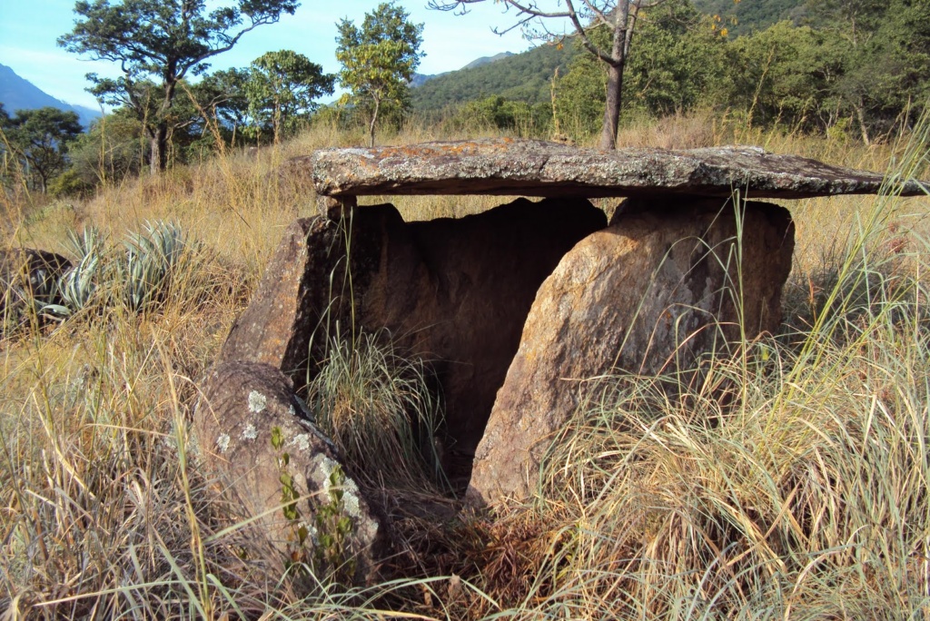
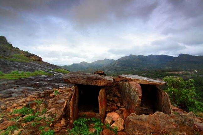
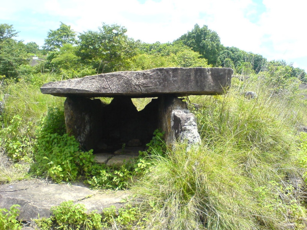
Dolmens in Marayoor
Megalithic Dolmens, also called Muniyaras, belong to the Iron Age. These dolmenoids were burial chambers made of four stones placed on edge and covered by a fifth stone called the cap stone. Some of these Dolmenoids contain several burial chambers, while others have a quadrangle scooped out in laterite and lined on the sides with granite slabs. These are also covered with cap stones. Dozens of Dolmens around the area of old Siva temple (Thenkasinathan Temple) at Kovilkadavu on the banks of the River Pambar and rock paintings on the south-western slope of the plateau overlooking the river have attracted visitors.
Apart from the dolmens of Stone Age, several dolmens of Iron Age exist in this region especially on the left side of river Pambar as is evident from the usage of neatly dressed granite slabs for the dolmens. At least one of them has a perfectly circular hole of 28 cm diameter inside the underground chamber. This region has several types of dolmens. Large numbers of them are over ground with about 70–90 cm height. Another type has a height 140–170 cm. There is an over ground dolmen with double length up to 350 cm. Fragments of burial urns are also available in the region near the dolmens. This indicates that the dolmens with 70–90 cm height were used for burial of the remains of people of high social status. Burial urns were used for the burial of the remains of commoners. The dolmens with raised roof might have been used for habitation of people. Why some people lived in the cemeteries has not been satisfactorily explained.
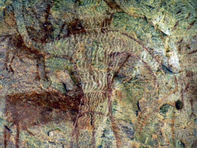
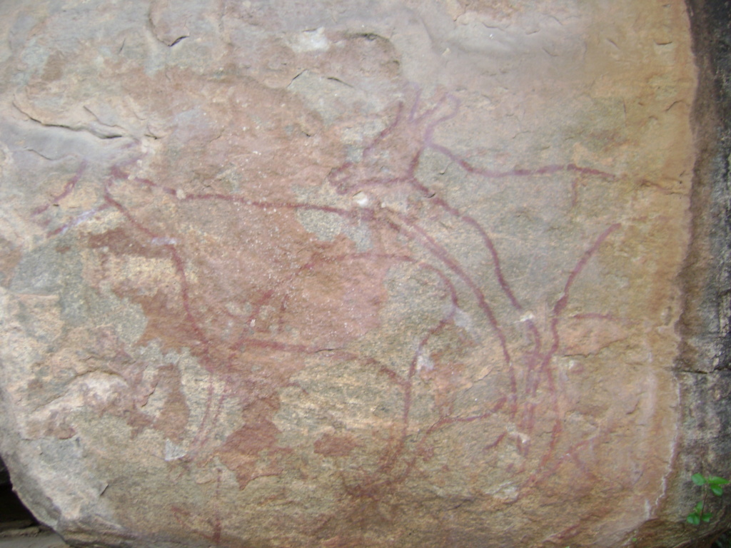
Rock paintings in Marayoor
Ancient rock paintings are part of Marayur heritage at Attala, Ezhuthu Guha (literally means “cave of writing”), Kovilkadavu and Manala in Marayur panchayat. Attala is situated in the west part of Marayur Township and more than 90 painted motifs can be seen here. The rock paintings of Attala are situated in a colossal east facing rock shelter 1500 meters above mean sea level. Most of the paintings at Attala are abstract designs except for a few human and animal figures. Ezhuthu Guha rock paintings are cited in the Koodakavu Sandalwood Reserve Forest at Marayur in the Marayur Panchayat at an elevation of 1000 meters above mean sea level. More or less 90 painted motifs can be seen here. However, as the place is the most famous rock art site in Kerala, it attracts a large number of visitors and has been extensively vandalized since it was brought to wide public attention.
Kovilkadavu is less than five kilometers from Marayur town and the place is famous for Neolithic dolmens and rock paintings. Ten 10 painted motifs are located on the south-western slope of the plateau overlooking the Pambar river. There is a rock painting at Manala in Chinnar Wildlife Sanctuary of Marayur near the Alampetty tribal settlement. Here, a picture of a deer and a man can be seen. In close proximity to this art site, a new rock painting has been newly discovered.

Mattuppetty
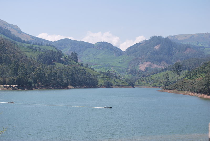
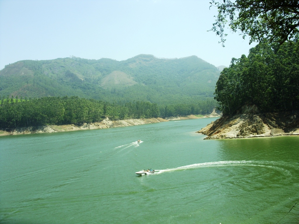
Situated at a height of 1700 m, Mattupetty is known for its highly specialised dairy farm-the Indo Swiss Livestock Project. Over a 100 varieties of high-yielding cattle are reared here. Visitors are not allowed here. The Mattupetty Lake and dam, just a short distance from the farm, is a very beautiful picnic spot. The sprawling Kundala tea plantations and the Kundala Lake are other attractions in the vicinity. DTPC Idukki provides boating facilities on the Mattupetty Dam. Speed launch and motorboats are available on hire. Wild elephants are seen here regularly.


Meeshapulimalai
Meesapulimala is a peak in the high ranges of Western Ghats in the Idukki District of Kerala. Standing tall at 2,640 metres above sea level, it is the second highest peak in South India. The trek up to Meeshapulimalai is much sought after by people looking for a long trek in Munnar especially as Anaimudi, the highest peak in South India is closed to general public for any activities. At a height of 2,640 meters the Meeshapulimalai Peak is indeed a spectacular peak and the view from the top is breathtaking! Once you get nearer the top, you truly feel on top of the world with clouds swirling around the peaks below!
There are 2 ways to access the peak. The more popular and easily accessible path is from the Silent Valley Estate. The other is from Kolukkumalai Estate. The peak can be accessed from both sides and can be done as a day trip albeit a long day! It is also possible to start your walk from Silent Valley Estate, walk up Kolukkumalai, walk down the other side and end your walk at the Kolukkumalai Estate or vice-versa. The walk up Meeshapulimalai and down to Silent Valley Estate is a much longer day than walking up from the Kolukkumalai side, the reason being Kolukkumalai is already at the base of the peak and also has the distinction of being the highest tea estate in the world!
You get to the top you traverse through diverse terrain ranging from carpets of tea bushes to lush evergreen shoals, pine forests managed by KFDC and the undulating grasslands at the top. The walk up the peak requires a reasonable amount of fitness and not recommended in the monsoon months of June-August. The high winds, thick clouds and heavy rains make it a difficult task to complete! The winter months of December to February can be very chilly in the morning and evening but hot once you get to the grasslands at the top of the peak. Do be prepared for the sun...it’s easy to get sunburnt at that altitude! Comfortable walking shoes are recommended and best to have some layers of clothing including some protection against wet weather! The weather at the top is totally unpredictable in the hills especially with the hot air from the Tamil plains working its way up meeting the cold mountain air!


Munnar
Munnar is a town and hill station in the south western state of Kerala, India. Munnar is situated around 1600 m above sea level, in the Western Ghats range of mountains at the confluence of three mountain streams - Muthirapuzha, Nallathanni and Kundala. The name Munnar is believed to mean “three rivers”, referring to the location at the confluence of the Muthirapuzha, Nallathanni and Kundaly rivers. Munnar town is situated on the Kannan Devan Hills village in Devikulam taluk and is the largest panchayat in the Idukki district in Kerala having an area measuring nearly 557 km².
Munnar is breathtakingly beautiful - a haven of peace and tranquility - the idyllic tourist destination in God’s own country. It has the perfect blend of nature with sprawling tea plantations, picture-book towns and winding lanes. Munnar was the favored summer destination of the erstwhile British rulers in the colonial days. One of the finest hill stations in India, it is among the most popular holiday destinations of Kerala. The restful resort town is a great getaway spot by its own. Waterfalls, wildlife sanctuaries and scenic spots located around town are that many to make it a traveller’s dream. Together they turn restful Munnar holidays quite eventful as well. Ideal for honey moon tours, sightseeing and plain idling, Munnar has also proved to be great for adventure activities. The contours and inclines of local landscape have already become a hot bed of adventure tourism. Munnar also has the highest peak in South India, Anamudi, which towers over 2695 m. Unending expanse of pristine valleys and mountains- exotic species of flora and fauna including the famous endangered mountain goat -Nilgiri Tahr. Munnar has all these and much more. It’s the place you would never like to leave.


Munnar Rose Garden
Munnar Floriculture Centre, popularly known as Munnar Rose Garden, is a beautiful garden with hundreds of rare varieties of flowers and herbal plants. With large tea plantations in the background, this is place is definitely worth a visit for everyone who enjoy flowers. Spread across a few acres of land and located along the Munnar - Mattupetty road, this place has an amenity centre for tourists and a sales outlet, in addition to hundreds of rare varieties of flowers, cactus, shrubs, creepers and herbal plants. The amenity centre inside the garden has toilets, shop, snacks, coffee etc. it is easily accessible without taking a lot of time from your itinerary.
Munnar Tea Museum
The Tea Museum is for cuppa lovers or for those who are curious about the development of tea in Munnar area. Here we can see the process off tea making. Located at Nallathani Tea Estate of Tata Tea Company, it showcases pictures and antiques, all related to Tea.
Murikkady
Murikkady is a beautiful location that is known for its well looked after coffee plantations. Cardamom and pepper are also extensively grown here. The place is a significant supplier to the many spice shops at Kumily.
Nadukani
A charming hill station and an ideal picnic spot to catch panoramic views of breathtaking proportions of the nearby low lying areas. It is around 25 km from Idukki. The name when literally translated means “see the lands”. This idyllic site perched on top of a hill is surrounded by lush greenery and huge boulders. A two storied pavilion has been erected here to better view the low lying areas draped in velvet greenery. The place is a photographer’s paradise offering picture postcard visions of the valley below with white streaks of silver streams cutting through the lush greenery. Moolamattom underground power station is another attraction close to Nadukani. The place is one of the boundaries of the Idukki Wildlife Sanctuary; hence, one can also get a glimpse of many rare species of fauna such as hornbill, wild rabbits, sambhar, jungle maina and elephants.
Painavu
Painavu is the administrative headquarters of Idukki district of Kerala. This forest township is an ideal location to escape from the hustle and bustle of the city. This picturesque town is the headquarters of Idukki district. Painavu is a place of amazing scenic beauty surrounded by evergreen forests and verdant mountains. It is also a preferred spot for trekking.
Palkulamedu
The panoramic views here are simply breathtaking. This popular adventure travel destination, located at a distance of about 12 km from Idukki, is set at an altitude of 3125 meters above the sea level. Views of the city of Cochin, Alappuzha and other towns could be seen from this peak on a bright sunny day.
Pallivasal
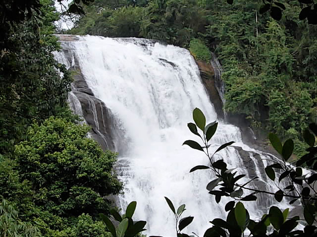
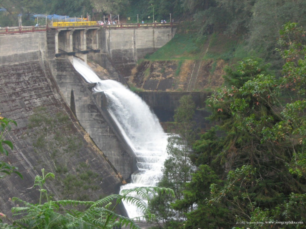
This is the venue of the first Hydro electric Project in Kerala and a place of immense scenic beauty. A famous attraction in the town is the Pallivasal Falls, which is a must see when in the area.The works for the first hydro electric power station in Kerala began at Pallivasalin 1933. On March 19, 1940, Sir C P Ramaswamy Aiyer, the Dewan of Travancore inaugurated the first stage of the Pallivasal project, which had an initial installed capacity of 13.5 MW. It was the first Hydro Electric Project in Kerala; set up to serve the power needs of the general public. The State Electricity Department also took over the 200 kw power station, set up in 1928 by the Kannan Devan Hill Produce Co. The Pallivasal project, at present, has a capacity of 37.5 MW (3x5 +3x7.5).
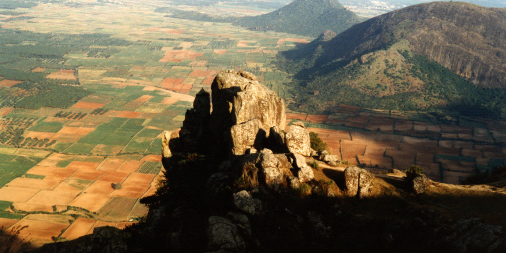
Parunthumpara
Parunthumpara is a small village, located between Peermade and Thekkady, on the way to Kottayam - Kumily road. The word ‘parunth’ in the local language means Eagle and ‘para’ means rock. It is called Parunthumpara or eagle rock because of a large area around like an eagle. This area provides a bird’s eye view of an endless stretch of green forest land and low-lying areas. If the sky is clear, visitors can get the view of the Sabarimala forests.
Easily accessible through the narrow ghat road from Kallar Junction, this hill station stands out for its sprawling grasslands where the families can enjoy a few quiet moments, away from the hustle and bustle of the city life. A perfect choice for those who wish to have a holiday off the beaten track and to explore the unseen and the unexplored beauty of the pristine forests around, Parunthumpara has been attracting a large number of domestic tourists during weekends. Though the place is yet to be included in the tourism map of the district, the place can stand up to any other hill stations. However, the steep hills also pose a threat to reckless visitors. There are a few deep slopes and one should be careful while visiting Parunthumpara.
Pothamedu
This is a popular location with trekkers and adventure tourists. The magnificently beautiful mountainous place has many hills making it a perfect spot to set out on challenging treks and mountain walks. Pothamedu is also known for the beautiful tea and coffee plantations and also the lush cardamom plantations.
Ramakkalmedu
Ramakkalmedu is a hill station located in the Idukki District at a height of 3500 feet above sea level. It is situated on the Kerala-Tamil Nadu state border. The name of this site is a combination of the three words ‘Ram’, ‘Kal’ and ‘Medu’, meaning Lord Rama, rock and land, respectively. It is believed that Lord Rama visited this place when he was searching for his wife Sita, who was abducted by the king of Lanka, Ravana. During his search, Lord Rama set foot on the tallest rock to look for Sita. This same rock was named as Ramakkal, which eventually came to be known as Ramakkalmedu.
The main tourism importance of this place is the presence of excellent wind from TamilNadu. Rolling green hills and the fresh mountain air make Ramakalmedu an enchanting retreat. The hilltop also offers a panoramic view of Tamil Nadu towns of Cumbum, Theni, Kombe, Thevaram, Uthamapalayam, Bodinaykannor and Vaiga. The sight is even wonderful at dusk when all these towns lighted.
Ramakkalmedu Kuruvan and Kuruthi Statue
Statue of Kuruvan and Kuruthi located at the top of one of the Ramakkalmedu hills is one of the major tourist sites in Ramakkalmedu. C.B. Jinan of Balaramapuram is the architecture of this famous statue. It was launched in 1st August of 2005. ‘Kuruvan’ and’'Kurathi’, are the two historical characters of the local community who’s name where given to the rocks between which the Idukki Dam was built. It believes that Kuruvan and Kuruthi found the place for the famous Idukki Dam.
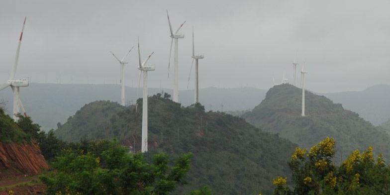
Ramakkalmedu Wind Farm
Studies have shown that Ramakkalmedu is the most suitable place for setting up the farm, as the area is blessed with uninterrupted and high velocity wind during the season. It is recorded that the wind effect of this site is the maximum in Asia as the wind gusts into the hills at a high speed and at very high pressure. Average wind speed here is 30.04 Km/h. The wind farm is an added attraction to Ramakkalmedu, which is known as a major tourism spot that provides a panoramic view of Tamil Nadu. Around 10,000 visitors come to the area each day since the launch of the windmill. Official sources say the cost of installing (excluding the land price) a wind unit is Rs.4.15 crore and the power generated is sold to the KSEB at a rate of Rs.3.15 paisa per unit as fixed by the Central Regulatory Authority. Each unit now produces 500 to 600 KWh electricity and it can reach 1,500 KWh calculated at a maximum speed of 24 rpm (revolution per minute). Companies such as Etton World, Sun Star, IBN, Zenith Energy, Eastern and Miton have installed units with technical support of Vestar India, an arm of Vestar Denmark, which at present has 35,000 wind farms in the world over.
This place also provides beautiful views of the sun rising in the eastern hills and setting on the western mountains. The mountains located adjacent to the site are surrounded by thick evergreen forests that serve as a natural habitat to various birds and animals. Situated at an altitude of around 3560 ft from the sea level, the area is popular for trekking, hiking, paragliding and camping.


Peerumadu
Peerumedu (also Peerumedu,peermade, Peerumade) got its name from Peer Mohamed, a Sufi saint, lived here in the 13th century. His burial chamber is in the nearby Peeru hills. It is calming, cool, away from the crowds and near the clouds. So it is a perfect choice for a short break or even a few relaxing days. The hill station is located along Thekkady to Kottayam road amidst a cluster of hills that guard plantations of tea, coffee, cardamom, vanilla and rubber. Eucalyptus and Pine woodlands, pastures, rocks, and cascades have taken over the rest of the misty landscape. No wonder it was once the summer
getaway of the kings. Travancore rulers even built a summer residence here. The heritage structure, converted to a Tourist Bungalow, now offers accommodation to visitors. Tourism Department manages it. Similar to most Kerala hill stations, sightseeing and nature walks are the usual activities. Many visitors also take up cycling, trekking, horse riding and even golf. Getting to local tribal settlements, enjoying sun rises and sun sets from Thrishanku hill, visiting neighbouring Peeru hill are other possibilities.
Thekkady/Periyar:
Thekkady in Idukki is a dream destination for any tourist visiting India. The 120 years old 'Surki' dam built across Peryiar, Poorna in Vedic parlance, is a major tourist attraction. Sprawled over an area of 925 Sq .km. it is one of the 50 tiger reserves in India surrounded by an artificial lake over an area of 25 Sq.Kms. Here the high ranges of the Western Ghats are clothed in dense evergreen, moist deciduous forests and savannah grasslands. Below this thick green canopy roam herds of elephants, sambars, tigers, gaurs, lion tailed macaques and Nilgiri langurs.
Periyar Tiger Reserve, Thekkady, is an example of nature’s bounty, with great scenic charm, rich bio diversity and providing veritable visitor satisfaction. Zealously guarded and efficiently managed reserve is a repository of rare, endemic and endangered flora and fauna and forms the major watershed of two important rivers of Kerala, the Periyar and Pamba. Thekkady is a pleasant heaven on earth for those who love nature in its wild manifestations.
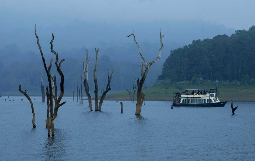
Thekkady is placed at an altitude of 700m above the sea level. Thekkady is a perfect retreat for anyone who loves adventure, fun, wildlife and nature. Nestled between the ever-green and semi-evergreen forests of Western Ghats, Thekkady has so many things to offer for the tourists who visit this place. Ferry boats are arranged by the Kerala Tourism Development Corporation and you can enjoy the wildlife and the surrounding nature while having a ride through the river. The sight of herd of elephants is an unforgettable experience. It will take around two hours to complete one boat ride. At the end of the ride you will be able to sight the walls of Mullaperiyar Dam.
Thekkady offers a very peaceful and calm atmosphere. The chill climate of Thekkady will refresh your mind and body. The forest areas around Thekkady is strictly uninhabited by the Forest Department to preserve the Mother Nature. The nearest town to Thekkady is Kumily, which is 4 kilometer apart. You can plan a calm walk though this town. This town is also a place for shopping. You can shop here handicrafts, spices and cloths.
Thekkady is a destination for all season. But, winter will be the best time to be at Thekkady. The cool and pleasant climate will help you to explore this place beautifully. Most of the festivals at Thekkady take place during winter season. Though summer season will not be a comfortable time for you to visit Thekkady, this will be a time, when you will be getting hotels and resorts in cheap rates. If you want to visit Thekkady without any rush, choose this season. Monsoon is another time to explore the real beauty of Thekkady. If you are a monsoon lover, don’t miss this opportunity.


Top Station
Top Station, located around 32 km away from Munnar, is the highest point (2000m) in Munnar. It is part of Theni District in the state of Tamil Nadu. It was a transshipment point for delivery of tea from Munnar to Bodinayakkanur. Top Station derived its name from its being the upper terminus of the Kottagudi Aerial Ropeway. It was also the location of the terminal railway station on the Kundala Valley Railway, built in 1902 between Munnar, Kundalai and this low point in the crest of the hills above steep cliffs. A monorail goods carriage system was initially installed along this cart route. In 1908 the monorail was replaced by a 24 inch gauge railway. Kundalai is 12 kilometers (7.5 mi) west from Top Station on the way from Munnar station.
Tea chests arriving at Top Station from the Kundalai Valley were transported by a ropeway from Top Station 5 km down hill to the south to Kottagudi, Tamil Nadu. The tea was then shipped 15 km by cart to Bodinayakkanur, then by rail to other places in India and ship to England. Remains of the ropeway station at Top Station are still visible. At this highest point, you may feel that the clouds are just a hand touch away from you. The destination is famous for the Neelakurinji flowers (Strobilanthus). Here you can enjoy the panoramic view of Western Ghats and the valley of Theni district of Tamil Nadu.


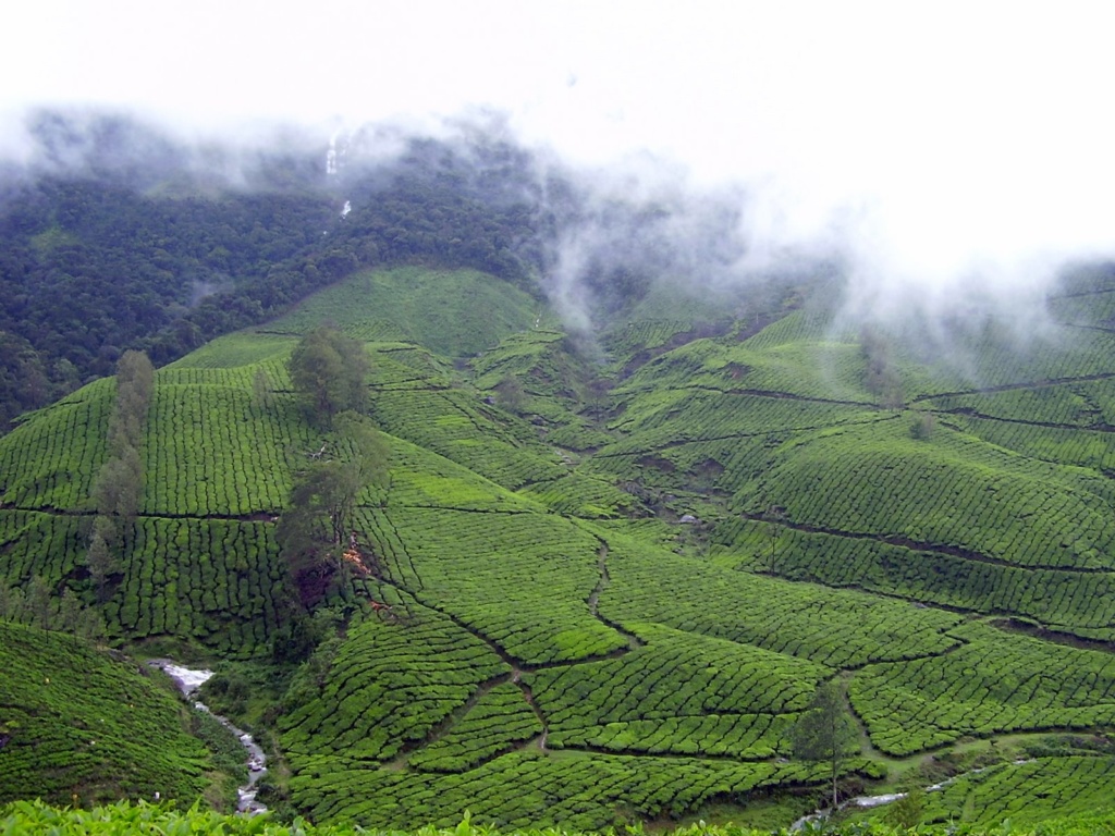
Vagamon
Vagamon is a hill station located in Kottayam- Idukki border of Kerala, noted for its misty meadows, splashing waterfalls, and exciting trekking paths. Nestled in the lap of the Western Ghats and surrounded by Shola forests, Wagamon is simply enchanting with the three hills - Thangal Hill, Murugan Hill and Kurishumala. What registers deep in the memories of a visitor to Wagamon is its unique aroma, medicinal plants and the dense pine forests here. The vast undulating landscapes, narrow valleys, the greenery of tea gardens, fresh cool air, murmuring Pine forest and waterfalls in rocky terrain everything adds to the adventure factor of Wagamon
The Vagamon hill station offers you a unique and different environ in comparison to other hill stations of Kerala. Besides, being abundant in natural beauty, the place also offers space for spiritual activities. The peaceful surroundings with cool and soft breeze blowing across the valley make it a perfect place for meditation. If you are willing to experience the peace of mind then Vagamon provides you the perfect conditions.
It has a cool climate with the temperature between 10-25°C during summer midday. The meandering road to Vagamon is cut in solid rock. Take a walk along the narrow, mist covered zigzag roads that wind up the hills and experience true bliss. And as you wind your way through green capped hills, the rolling plains come into view thousands of feet below you. For adventure seekers, there is an option of trekking, paragliding and rock climbing.


Vagamon Green Meadows
Imagine Plush Green Grass Lands with cool breeze going around all day long and you in the middle of all this….. You probably should be here!, that’s right Vagamon Grass Lands… you can find it everywhere at Vagamon… No Better Place than this. You see the never ending hills of Vagamon all round you and no one to disturb you, you and your peace of Mind…. That’s it when you are here.
Vagamon Kurisumala
Kurisumala Ashram, a monastery of Christian ascetics is at the heart of the Sahya Mountains, which run parallel to India’s south west coast. It is a place sanctified by the breeze which blows softly across the valleys and by the overwhelming beauty of the creation, and the meditative thoughts which arise from the depth of silence. The main day of attraction is on Good Friday. This is where hundreds of devotees from far and near converge during the holy week and after to climb the hill carrying wooden crosses.
Vagomon Pine Forest
If you need some privacy and that too on the natures lap, this is the perfect place to be. Having a nap in the pines or having a long stride through the Pines, you will forget everything that you have had at your Office or whatever…. You can’t miss it... Keep some time aside to enjoy this place - The Vagamon Pines, we assure you, you don’t want to leave this place so soon….. or worse never!
Vagomon Thangal Para
A journey of about five kilometers from Vagamon, down the Elappara route, will take you to the Thangal Para, place of religious significance to Muslims. There is a Durgah here which is the resting place of Husrath Sheikh Fariduddin Baba, a Sufi saint, who is believed to have reached Kerala from Afghanistan about 800 years ago. Ganjusakkar (a sweet dish) is the main offering here and the festival, Uroos, is conducted during the month of April.
Vattavada
The serene village of Vattavada is located about 42 km east of Munnar. At Vattavada, in comparison to other regions in Munnar, instead of tea plantations, it is the predominance of vegetables that occupy the terraced slopes and valleys of Vattavada. The scenic hilly tract of Vattavada is at an altitude of 6500 feet above sea level, and is a refreshing experience, which is yet to come under the constant gaze and the footprints of visitors. The place receives plenty of sunshine and the winter temperatures never dip below unbearable levels. Besides the slopes of vegetable fields, one could also find forest patches, interspersed with eucalyptus and conifers.
Vattavada could be taken for a place significant for trekking. Here, an avid trekker would get options to explore many adjoining locations. Some of the trekking routes starting from Vattavada include the ones going to Kodaikanal, Top Station, Madupetty, Kanthaloor and Meesapulimala. Most of these treks offer enough excitement in terms of negotiating the terrain as well as enjoying the floral and faunal wealth on its course. Visitors could also engage in activities like mountain jeep safari, mountain biking, jungle camping etc. offered by private operators in the region. The local populace of Vattavada has a significant number of tribals. Their way of life, art forms, language, natural remedies are some of the other interesting aspects that could be of interest to visitors coming to Vattavada.